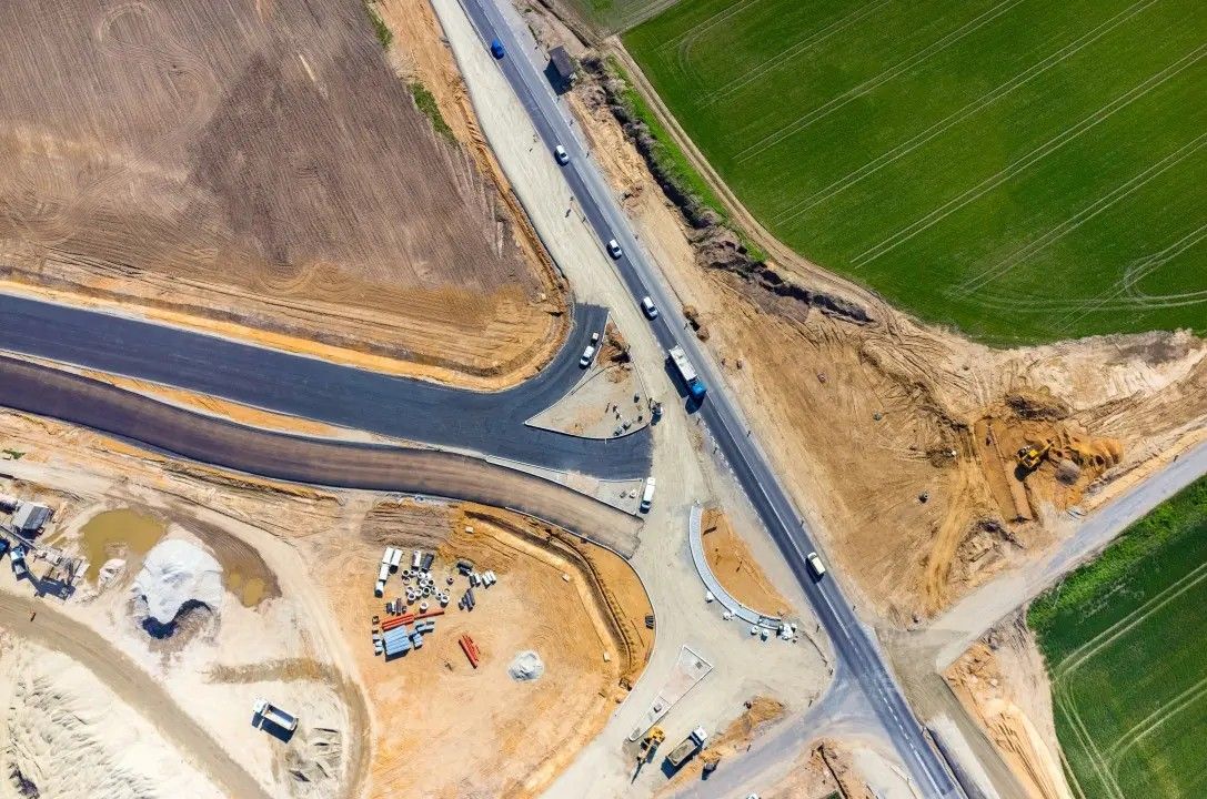
The Future of Aerial Precision: Unlocking the Power of Drone Mapping Services
In recent years, drone mapping services have revolutionized the way industries collect, analyze, and visualize geographic information. With advancements in drone technology and mapping software, businesses across various sectors are leveraging aerial imagery to enhance decision-making and optimize operations. This article delves into the essentials of drone mapping services, their applications, benefits, and answers some frequently asked questions that businesses may have.
Understanding Drone Mapping Services
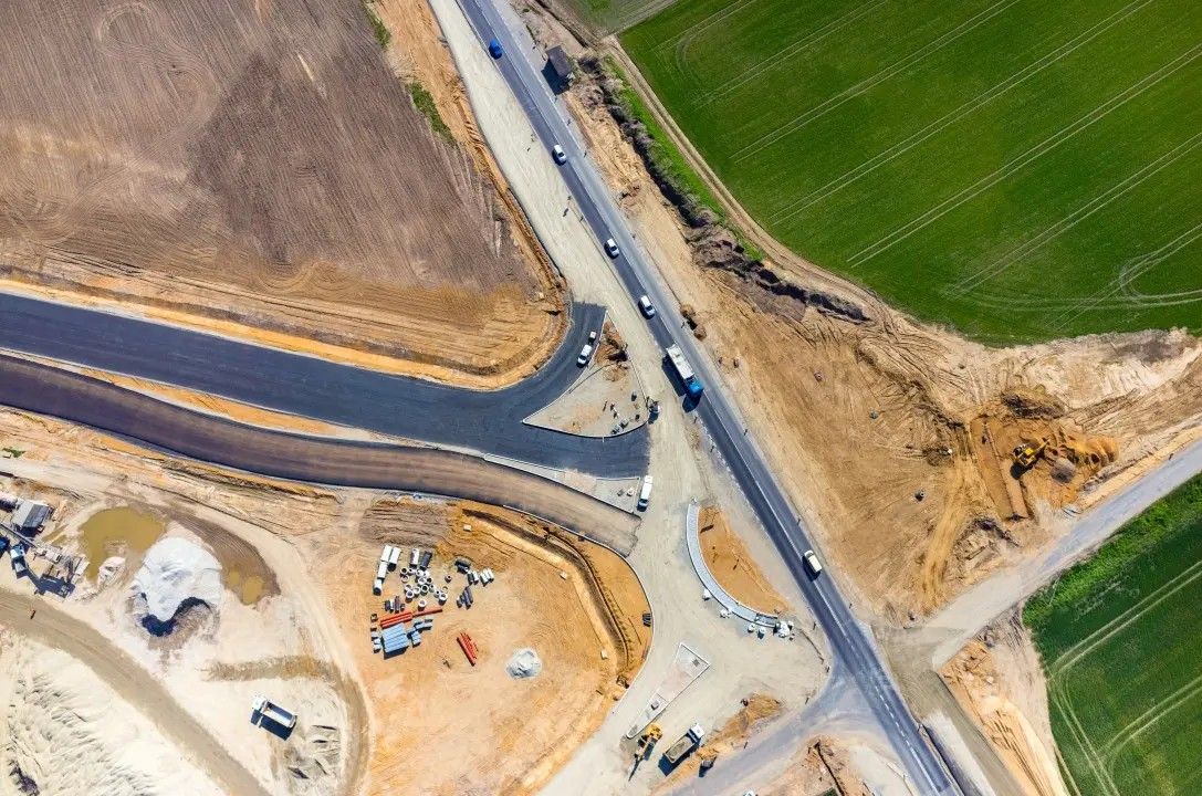
Drone mapping services utilize unmanned aerial vehicles (UAVs) equipped with advanced cameras and sensors to capture high-resolution images and collect geographic information. These images are then processed using specialized software to create detailed maps, 3D models, and orthomosaics. The technology provides a high level of accuracy and detail that traditional mapping methods often lack.
Key Components of Drone Mapping
Drone Hardware: Modern drones are designed specifically for mapping and surveying. High-resolution cameras, GPS modules, and LiDAR sensors are frequently used to capture detailed aerial data.
Mapping Software: Software applications like Pix4D, DroneDeploy, and Agisoft Metashape process the captured data to create various outputs, including 2D maps, 3D models, and point clouds.
Data Analysis: Once the data is processed, it can be analyzed to derive insights, validate compliance with regulations, or support project management efforts.
Applications of Drone Mapping Services
Drone mapping services are employed across a wide range of industries, mainly due to their efficiency and cost-effectiveness. Here are some key sectors transforming their operations with drone mapping:
1. Agriculture
Farmers use drone mapping to obtain valuable insights into crop health, optimize irrigation practices, and assess soil conditions. Aerial imagery enables precision agriculture, where farmers can make informed decisions about resource allocation to maximize yield.
2. Construction
In construction, drone mapping assists in project planning, progress monitoring, and site inspections. Drones provide real-time data, which helps project managers identify issues early and ensures projects stay on schedule and within budget.
3. Real Estate
For the real estate industry, drone mapping offers breathtaking aerial views of properties, giving potential buyers a clearer understanding of the landscape, property boundaries, and neighborhood features. This use of technology enhances property listings and marketing efforts.
4. Environmental Monitoring
Drone mapping services are essential for environmental monitoring tasks, such as tracking deforestation, monitoring wetlands, and assessing the impact of natural disasters. Drones can cover large areas quickly, providing crucial data for conservation efforts and environmental agencies.
5. Mining and Resource Management
In the mining industry, drone mapping services are used for surveying and monitoring stockpiles, assessing site safety, and managing exploration sites. Drones provide valuable data that help streamline operations and improve safety protocols.
Benefits of Using Drone Mapping Services
The adoption of drone mapping services comes with numerous advantages:
1. Enhanced Accuracy and Efficiency
Drone mapping provides a high level of accuracy, often within centimeters, compared to traditional methods. The ability to collect data quickly reduces project timelines and labor costs.
2. Cost-Effective Solutions
Using drones reduces the need for extensive manpower, equipment, and time previously required for ground surveying. This cost-effectiveness allows businesses to allocate resources to other critical aspects of their operations.
3. Real-Time Data Collection
Drones can capture data and provide insights almost instantly, enabling companies to respond quicker to changing conditions and make informed decisions promptly.
4. Safety Improvements
Drone mapping minimizes the need for personnel to access potentially hazardous areas. In industries like construction and mining, drones provide a safer alternative for data collection.
5. Detailed Visual Insights
The high-resolution images and 3D models generated through drone mapping offer planners and decision-makers a clearer and more comprehensive understanding of their project sites.
Challenges and Considerations
While drone mapping services present numerous benefits, they are not without challenges:
1. Regulatory Compliance
Drones are subject to regulations that vary by region and country. It is crucial to ensure compliance with local laws to avoid legal issues.
2. Weather Dependency
Weather conditions can significantly affect drone operations. Rain, strong winds, and fog may limit the ability to capture quality images.
3. Data Management
The volume of data collected by drones can be substantial. Businesses must have the appropriate infrastructure to store and manage this data effectively.
Frequently Asked Questions (FAQs)
Q1: How long does it take to conduct a drone mapping project?
The duration varies based on the size and complexity of the site. Smaller sites might take a few hours, while larger complex projects can extend to several days.
Q2: What industries benefit most from drone mapping services?
Drone mapping is beneficial in agriculture, construction, real estate, environmental monitoring, mining, and many more sectors.
Q3: Is drone mapping more expensive than traditional surveying?
While initial costs may seem high, drone mapping is often more cost-effective in the long run due to reduced labor and time spent.
Q4: Can drones operate in bad weather conditions?
Drones are generally not operated in adverse weather conditions, such as heavy rain or strong winds, to ensure safety and maintain data quality.
Q5: How accurate are drone maps?
Most modern drone mapping systems can achieve accuracy levels of a few centimeters, making them suitable for a variety of applications requiring precision.
Conclusion
In summary, drone mapping services represent a significant advancement in geographic data collection and analysis, offering unparalleled accuracy, efficiency, and cost-effectiveness. As technology continues to evolve, the potential applications of drone mapping will expand even further, paving the way for innovative solutions across various industries. Embracing this technology can enhance decision-making, improve operational efficiency, and provide valuable insights that drive success in the modern business landscape.
Appreciate the creator