Atlas Mountains Map for Travelers: Everything You Need to Know
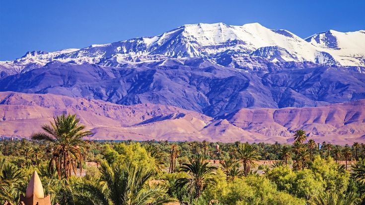
Planning a journey to North Africa is an exciting experience, and understanding the Atlas Mountains map can make your adventure smoother and more enjoyable. Stretching across Morocco, Algeria, and Tunisia, the Atlas Mountains offer breathtaking landscapes, traditional villages, scenic hiking trails, and unforgettable cultural experiences.
Whether you're a first-time visitor or an experienced traveler, having a good understanding of the region's geography helps you choose the best destinations and travel routes.
Where Are the Atlas Mountains?
The Atlas Mountains form a vast mountain system in northwestern Africa. They extend for approximately 2,500 kilometers, creating a natural barrier between the Mediterranean coast and the Sahara Desert. The range passes through three countries:
· Morocco
· Algeria
· Tunisia
Morocco is home to the most famous and accessible sections of the mountain range, making it the preferred destination for most international travelers.
Why a Mountain Map Matters
An atlas mountains map detailed map helps travelers understand how different regions connect and what attractions are located nearby. The mountains are divided into several ranges, each offering unique scenery and activities.
Using a reliable travel map allows you to:
· Plan efficient road trips.
· Estimate travel times.
· Locate hiking routes.
· Identify nearby towns and accommodations.
Explore national parks and cultural sites.
Whether traveling by car, bus, or with a guided tour, proper navigation saves time and enhances your overall experience.
Main Mountain Ranges
The Atlas system consists of several distinct mountain ranges.
High Atlas
Known as the highest section of the range, the High Atlas contains North Africa's tallest peaks. This area is popular for trekking, mountain climbing, and photography. Traditional Berber villages are scattered throughout the valleys, providing authentic cultural experiences.
Middle Atlas
The Middle Atlas is famous for cedar forests, cool weather, and diverse wildlife. Visitors often come here to enjoy nature walks, waterfalls, and peaceful mountain towns.
Anti-Atlas
Located in southern Morocco, the Anti-Atlas features rocky landscapes, dramatic cliffs, and desert-like scenery. It offers a quieter alternative for travelers looking to avoid crowded tourist destinations.
Tell Atlas
Stretching across northern Algeria and Tunisia, the Tell Atlas receives more rainfall than other sections, making it greener and more fertile.
Saharan Atlas
Running parallel to the Sahara Desert, this range creates a fascinating transition between mountainous terrain and vast desert landscapes.
Understanding the Atlas Mountains Map
Reading the Atlas Mountains map becomes easier once you recognize the major cities surrounding the range.
Key gateway cities include:
· Marrakesh
· Fez
· Ouarzazate
· Beni Mellal
· Ifrane
Most travelers begin their mountain adventure from Marrakesh because it provides quick access to the High Atlas through well-maintained roads.
The map also highlights major mountain passes, valleys, rivers, and protected parks that are worth exploring.
Best Places to Visit
The Atlas Mountains are filled with incredible attractions suitable for every type of traveler.
Mount Toubkal
As the highest peak in North Africa, Mount Toubkal attracts thousands of hikers each year. Guided climbs usually take two days and reward visitors with panoramic views from the summit.
Ait Benhaddou
This UNESCO World Heritage site features an ancient fortified village built from earth and clay. It has appeared in numerous famous films and television series.
Ourika Valley
Located close to Marrakesh, Ourika Valley offers waterfalls, riverside cafés, and beautiful hiking trails. It is an ideal day-trip destination.
Imlil
Imlil serves as the main starting point for many High Atlas treks. The village offers guesthouses, restaurants, and experienced local guides.
Ifrane National Park
Often called the "Little Switzerland of Morocco," this area is known for alpine-style architecture, cedar forests, and Barbary macaques.
Transportation Tips
Traveling around the mountains requires careful planning.
By Car
Renting a car offers maximum flexibility. Many roads are paved, although mountain routes can become narrow and winding.
By Bus
Public buses connect major cities with nearby mountain towns. They are affordable but may require additional local transportation to reach remote villages.
Guided Tours
Many visitors choose organized tours that include transportation, accommodation, and local guides. This option is especially helpful for travelers unfamiliar with mountain driving.
Best Time to Visit
The ideal travel season depends on your interests.
Spring (March to May)
Spring brings colorful wildflowers, pleasant temperatures, and excellent hiking conditions.
Summer (June to August)
Higher elevations remain relatively cool, although lower valleys can become quite warm.
Autumn (September to November)
Autumn offers clear skies, comfortable weather, and fewer tourists, making it one of the best seasons to visit.
Winter (December to February)
Snow covers many peaks during winter, creating beautiful scenery and opportunities for winter sports in certain areas.
Packing Essentials
Mountain weather changes quickly, even during summer.
Travelers should bring:
· Comfortable hiking shoes
· Warm clothing
· Waterproof jacket
· Sunscreen
· Sunglasses
· Reusable water bottle
· First-aid kit
· Portable power bank
· Offline maps
· Camera
Being prepared ensures a safer and more enjoyable journey.
Cultural Experiences
The Atlas Mountains are home to Amazigh (Berber) communities with centuries-old traditions.
Visitors can experience:
· Traditional local markets
· Handmade carpets
· Pottery workshops
· Authentic mountain cuisine
· Mint tea ceremonies
· Local music and dance performances
Respecting local customs and supporting family-owned businesses helps preserve the region's rich cultural heritage.
Safety Tips
The mountains are generally safe for tourists, but a few precautions are recommended.
Check weather forecasts before hiking.
Carry enough drinking water.
Stay on marked trails.
Hire local guides for challenging routes.
Inform someone of your travel plans.
Keep cash available for remote areas where card payments may not be accepted.
Good preparation minimizes risks and makes your adventure more enjoyable.
Using Digital Navigation
Modern GPS apps make traveling much easier, but mobile coverage may disappear in remote mountain areas. Downloading offline navigation before your trip ensures you can continue following your planned route without an internet connection.
Combining digital tools with printed maps provides extra security during longer road trips and hiking adventures.
Final Thoughts
Exploring North Africa's spectacular mountain landscapes becomes much easier with a clear understanding of the Atlas Mountains map. From towering peaks and green valleys to historic villages and vibrant local culture, the region offers unforgettable experiences for every type of traveler.
Careful planning, proper navigation, and respect for local traditions will help you enjoy a safe and memorable journey through one of the world's most fascinating mountain systems.
Appreciate the creator